Summary
We climbed to the summit of Mount Kilimanjaro (19,340 ft), the
highest point in Africa. We joined Tonya on her already planned
trip through Abercrombie & Kent (A&K), a high end travel
group. Tonya had chosen the 7 day/6 night route starting at
Machame Gate and ending at Mweka Gate, because it is less traveled and
the longer trip provides better opportunity for acclimatization and thus
higher likelihood that you reach the summit. The actual climb is
more like a very long walk up stairs (~60 miles up/down). The pace
was rather slow for Dan's liking -- the world record for the fastest
climb/descent is 18 hours! Enduring 6 nights of very cold camping, no matter
how luxurious, is always challenging, and 7 days of continuous hiking
with the final trek to the summit as a midnight-to-6AM very steep
very-sub-zero temperature hike makes for sore legs! But we reached
the summit and have the pictures to prove it!
Below are general points about the trip, and then we provide the
day-to-day details.
General
There are a number of routes up Kilimanjaro, all requiring the use of
a guide and porters. Many people (~35%) do not reach the summit
because of altitude sickness. The Machame Route offers a varied and gradual ascent, taking longer than
other routes to
provide better acclimatization. In addition to the longer route,
we each were taking Diamox to reduce the chance of getting
altitude sickness. Since Diamox is a diuretic, one side effect is
having to get up in the middle of the night to use the bathroom.
And you also have to drink lots of water to avoid altitude sickness, so there
was no way around the late night wake-ups. However, it did force
(or enable) us to see the beautiful full moon, stars, and
moon-illuminated summit each night.
The weather followed a consistent pattern for the entire trek. It was
beautiful and sunny in the mornings, clouds would roll in and out very
quickly late morning through early afternoon, then typically it would rain in the
later afternoon, then beautiful and clear, but cold, over night. Of course, the
lowest and highest altitudes varied from that pattern, but the majority of the
trip was consistent. Our goal was always to get to camp before
the afternoon rain, though that was not always possible.
The terrain on Kilimanjaro falls into very clear categories. The
lower altitudes are forest, the middle is heather and moorland,
and the top is basically desert. It was very easy to tell when we
crossed the terrain boundaries.
We were a bit taken aback at the number of porters required for
our trip. For the 3 of us, we had 2 guides, and 15
porters. They said we each needed one porter to carry our luggage,
one to carry our 12 bottles of water for the week, and then the
additional porters to carry the camping equipment and food. Each porter
carried 40-50 pounds on their heads. Still, they always beat us to
each campsite. Since every touring group required a large
number of porters, the camps were always full with many more porters than
trekkers.
We were fortunate that another A&K trekking couple from Chicago
(Liz and Ian) was going the same route at the same time with us.
We each had our own guides, and mess tents, but the porters set the
tents up next to each other so we were able to hang out at the camps. They were
pretty cool, and we all supported each other through the trek.
An A&K tour typically has maximum 'coddling' (Tonya's word
for the right amount of attention). A great example -- they set up a private
toilet for us at each camp! It was always the last item
to be removed when the porters broke up the camp. In a camp with hundreds of people (majority are
porters), where everyone is finding their bathroom in some of the few
huts or in nature, we had a private curtain with a freshly dug hole and a toilet seat. We know this seems like way more
information than you wanted, but a toilet seat changes a whole part of
camping (for the better!) Other A&K luxuries included their
cleaning of our boots after the first day's hike through the muddy forest,
hot water and soap outside our tent to wash our hands before every meal,
tea delivered to our tent as a wake-up call each morning, and lunch
tents on the trail. Also, when in Arusha, the A&K vans never
had to stop at the frequent police road blocks.
Food on the trek was plentiful at our 3-4 meals a day. After wake
up tea at 6:30 AM, breakfast was served at 7:15. Typically
breakfast was porridge, toast, cereal (if we wanted), fruit, and a fried
egg. Lunch varied somewhat but typically included soup, chicken, a
pasta, and fruit. Dinners varied also but included soup, pasta,
potato, and a vegetable. If we had not been careful we could have
gained weight on this trip!
One of the biggest complaints by Dan on the trek was the painfully
slow pace at which we walked each day. Even with his very limited
breathing situation (see Hospital), he was
mentally strained from the snail's pace. He counted the the pace
as "step-one-thousand-one-step, step-one-thousand-one-step,
etc." So the trip was aerobically disappointing
(exercise-wise) but definitely a great leg work-out given that we hiked
nearly 60 miles of varying steepness in 7 days.
Detail
Day 1 - Machame Gate to Machame Camp (~9000ft)
We started at the Machame Gate and walked up a slightly ascending
path into the forest. The slow pace was already evident, even on
this almost level easy path! But once we got into the forest and
the deep mud, we had no choice but to go slowly as we searched for roots
and logs to walk on to get through the mess. As it started to
rain, the mud got worse. We wore rain pants and Tonya had gaiters,
so the mud was not that big a deal, except that at times it was deep
enough to go above the boot line.
We hiked 18km in 7+ hours on this first day. Towards the end of
the hike, it was on the verge of raining, so fortunately one of the
guides allowed us (Kristen and Dan) to pick up the pace to avoid the
rain.
When we had our midnight bathroom break on this first night, we saw the first moonlit views of
the summit -- it was very cool. The full moon lit up the ground so
brightly that we did not need flashlights to walk around.
We took pictures of the summit and the moon, but the summit pictures
did not turn out -- still have not mastered night pictures with the
digital camera!
Day 2 - Machame Camp to Shira Camp (~12,800 ft)
On the second day the path was a bit steeper, and so we went even
slower! We hiked for about 6.5 hours to Shira Hut. It was
cloudy most the day but did not rain on us.
This was our first day of the tented lunch. As we came over the
top of a hill, we saw two tents set up with all the porters sitting
around. We thought that maybe we had completed the hike and made
it to the next camp site already. When we realized it was set up
just for lunch we were a little embarrassed (Tonya was very pleased with
it:). When some of the other non-A&K trekkers passed us and
sat out in the open with their bag lunches, it made us even more
uncomfortable -- of course, we could live through it!
On that night's midnight rising, we witnessed an amazing lightning
storm in the far-off clouds on the horizon. Even though it was
only 20°F we stayed out there for 20 minutes watching the
amazing show. We took about 20 pictures but it was hard to
time it just right, so we only got a few good ones.
Day 3 - Shira Camp to Lava Tower (~16,000 ft) to
Barranco Camp (~13,500 ft)
On the third day we ventured to almost 16,000 feet to Lava Tower to
help in the acclimatization process. We only stayed up there for a
few minutes then descended to the Barranco camp for the night. We
hiked for 7+ hours on this day. The terrain for most the day was
only a gradual incline, so Dan asked the guide if we could split the
group and go a little faster -- he said 'no way'. Of course, it
was the guy who could not take in more than a 1/4 to 1/2 breath since we
started the hike asking to go faster, so he must have thought we were
crazy!
The descent from Lava Tower gave us the first sense of what it would
be like to walk down the mountain after reaching the top. It was
extremely painful on the legs and especially the knees.
It rained on us most the afternoon, but was again clear at night. We
could see the Arusha city lights from Barranco Camp.
Day 4 - Barranco Camp to Karanga Valley Camp
(~14,000 ft)
Our route provided for higher altitude but shorter hikes on day 4 and
early day 5 to better enable us to make the summit in late day 5.
The day 4 climb from Barranco Camp to Karanga Valley was our favorite
hike of the trip. We got to climb the 1000m nearly vertical
Barranco Wall. It was definitely not real rock climbing but we had
to climb with our hands along somewhat dangerous edges so it was
fun. We also did it at a pretty fast pace. It only took 3 hours
to scale the wall and get to Karanga Valley camp. The porters had
the hardest time on this day -- it was very difficult for some of them
to climb the steep rocks with 50 pounds of uneven weight on their
heads. Understandable, of course.
Day 5 - Karanga Valley to Barafu Camp (~16,000 ft)
We only hiked 2.5 hours to get to Barafu camp but it was all up
hill. It was a short hike because we had to depart at midnight for
the summit.
Even though it was mostly sunny it was very cold. We rested
after lunch, had an early dinner, then slept for a few hours before our
departure for the summit. We wore everything we planned to wear to
the summit to bed, so that we could be ready to go when they woke
us. It is a bad sign when even with all the warm clothes on, we
were still cold in the tent -- a worse sign for the cold to come at the
summit!
Day 5/6 - Barafu Camp to Uhuru Peak (19,340
ft)
to Mweka Camp (~9,000ft)
We woke up at 11:30PM and left for the summit at 12:15AM.
The plan is to reach the summit around sunrise, take pictures, then
descend back to Barafu camp for lunch, then descend to Mweka Camp for the
night. This plan enabled us to get off the mountain the next day,
and removed all altitude issues at day 6 camp since Mweka is only 9,000
ft. It makes for a long day 5/6 but most of the treks have you
climbing to the summit overnight and descending that same day.
Tonya had planned the climb around the full moon, and it was paying off.
It was so bright at midnight that we did not need to wear our headlamps
to see the path up the mountain. We were wearing everything warm
we had, but it was still very cold. The first 30 minutes of the
hike was pretty flat, but then it got very steep. for the rest of the
way. Both of us were going bonkers at the super slow pace we were
taking on the hike. It was not that we were in a rush, but we were
barely moving, which was doing nothing to help warm us up. Also,
on that level of incline, when you "take a small step, wait
one-thousand-one, take another small step", it is very hard for us
to keep our balance. Kristen started double stepping to keep warm
and help with balance, and Dan moved his arms to try to stay
warm.
As we increased altitude, Dan's breathing became much more of an
issue. Even though we were not moving very fast, he was taking in
less than 1/4 breaths and was at times dizzy. His breathing had
been at that level most of the week but with the thinner air it was having
a bigger impact. Dan had some light thoughts about not continuing
the climb for safety reasons, but figured we would know if it got too bad. One
saving grace, as odd as it seems, is that Wilbard, our lead guide, let
us move a bit faster. This helped our motivation, warmth, and
balance (not much impact on breathing). The last 45 minutes of the
ascent to Stella's Point, the plateau just before an easy ascent to the
Uhuru Peak was extremely steep and over frozen 'scree'. We had to
concentrate on each step to ensure that we did not slip back 3 steps! We
passed a number of groups and could hear a bunch of people coughing and
vomiting from altitude sickness.
We reached Stella Point in about 5.5 hours. We waited for
Tonya and the other guide for about 10 minutes, but then decided we
would wait at Uhuru Peak instead. The path from Stella Point to
Uhuru Peak is all snow/ice, but not that steep, especially not compared
to what we had just gone through.
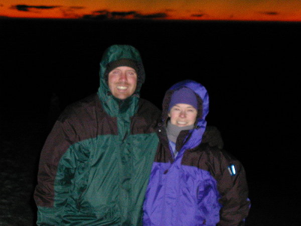
We reached Uhuru Peak at 6:17AM. The sun had not yet risen and
it was bitterly cold! We checked our thermometer and it was
-10°F. With the 20-30MPH wind the windchill was 40-50°F BELOW
ZERO (according to the graph on the back of our
mini-thermometer)! The pictures are not perfect because it was
that pre-sunrise light when camera flash is too bright, but it is not light
enough to take a good picture without it. We took our pictures and then waited for about 25
minutes for Tonya to arrive so that we could get a picture with her.
During this time we got to see the spectacular sunrise!! It was
quite cool to be on top of Africa watching such as magnificent event. As soon as Tonya got
there we took some quick pictures and started the descent. Actually,
by that time the sun was up and it had begun warming up to an almost
bearable temperature.
We descended by a little different path than the we came up, but it was very
difficult. The route was a very steep decline over scree (no
longer frozen ), which is a light layer of dirt and gravel intermixed
with bigger rocks. On any step, one foot could slide out from
under you and lay you on your back, sliding on the gravel (happened a
couple of times!) The safest but slowest approach was to walk
sideways down the slope.
We took a quick 20 minute nap when we got back to Barafu camp.
They had grilled cheese sandwiches for lunch -- that was a treat!
Right after lunch we walked another 4 hours down to Mweka camp.
Day 7 -- Mweka Camp to Mweka Gate
For some reason Mweka camp was extremely crowded. We were not
sure where all the people came from since it is on a descent-only
route. But since it was our last night camping and we had hiked
the whole night before, we were so tired that nothing mattered but
getting some sleep.
The 4 hour hike from Mweka camp to the gate was similar to our first
day on the trek -- all mud! With tired legs from the previous 6
days it was quite a challenge. Poor Tonya had 3 big falls all on
the same spot of her back side!
When we reached the gate, the porters sang us the 'Kilimanjaro Song'
as congratulations for reaching the summit (not sure what they did for
those that did not). We also received numbered certificates for
reaching the summit.
|